Halesowen Line - Virtual Trip
This page takes you on a virtual
trip along the
line.
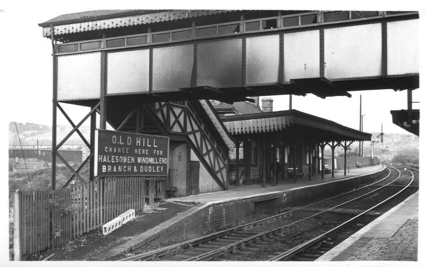
Old Hill Stn - 21/9/52
|
|
|
|
| Old Hill station, the start of
the line. Actually, the line from Old Hill to Halesowen was built
by GWR before the Halesowen Railway was created. David pointed
out the following:- "Note the station name board which still recorded the Halesowen branch public passenger service, which was withdrawn on 5 December 1927." |
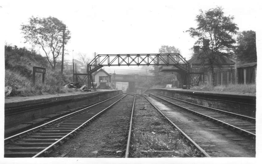
Halesowen Stn - 7/10/56
|
|
|
|
| Halesowen Station looking very
sorry for itself. This view was taken looking towards the start
of the Halesowen Railway proper. The road bridge
carried Mucklow Hill. |
Nr Halesowen Station - 14/10/51
|
|
|
|
| This view is taken from the
other side of the Mucklow Hill road overbridge seen in the picture
above. The factory building was Walter Somers
foundry, the chimney of which can be seen in the picture below. Of particular note is the water tower to the left of centre. David provided this information about the tower:- "An interesting point is that the tank was owned by the Midland Railway and if a Great Western engine made use of it, a ticket had to be made out and sent to Derby, so that the Midland could charge the Great Western for the water." |
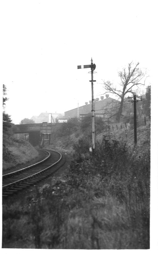
Halesowen Station Home Signal - 10/5/53
|
|
|
|
| Nice shot, this one. We're
approaching Halesowen Station from the south. The 'Home Signal'
referred to in the title is the same signal seen in the picture above. |
Manor Lane, Halesowen - 18/1/59
|
|
|
|
| Here the railway crosses over
Manor Lane, now known as Manor Way. Although the road has been
widened since this picture
was taken, this view looking towards Birmingham shows a factory to the
right and houses to the left that survive to this day. The line to the left would be from Halesowen, heading towards Hunnington off to the right. |
Hunnington Stn - 12/7/53
|
|
|
|
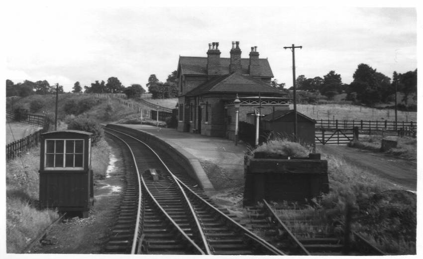
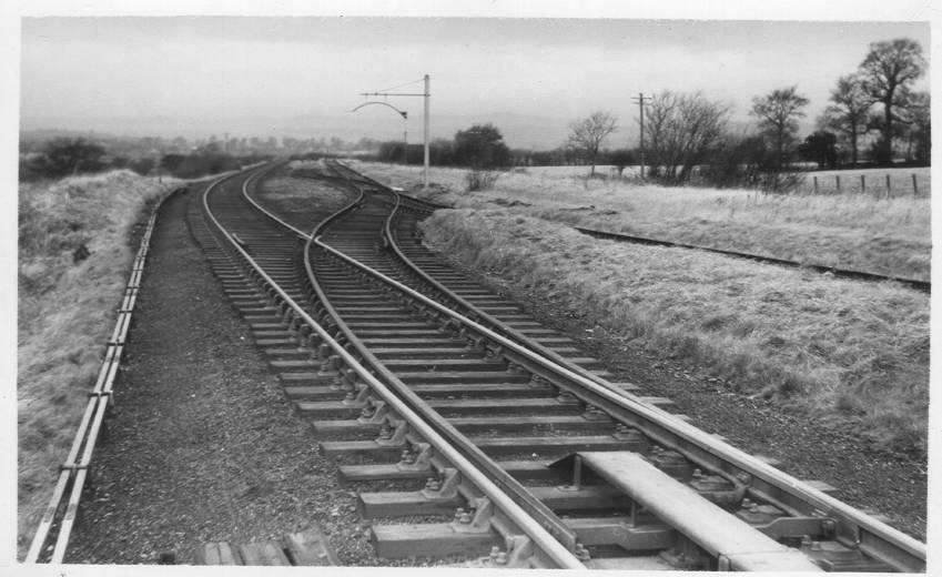
| Hunnington is just north of
Romsley. The station building survives to this day and is now a
private house. A modern day picture can be seen on the MIAC site. This
view is looking towards Rubery. I understand that the points seen in the foreground of the picture allowed goods trains to access sidings for the Bluebird Toffee factory. |
Hunnington Stn - 29/7/51
|
|
|
|
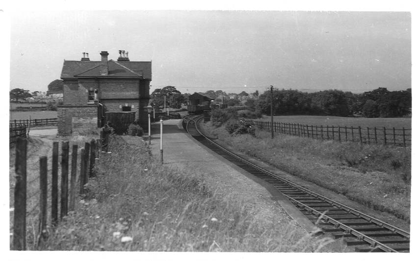
| Looking in the opposite
direction to the view seen directly above, this shot shows a small shed
and sidings to the north of the station. |
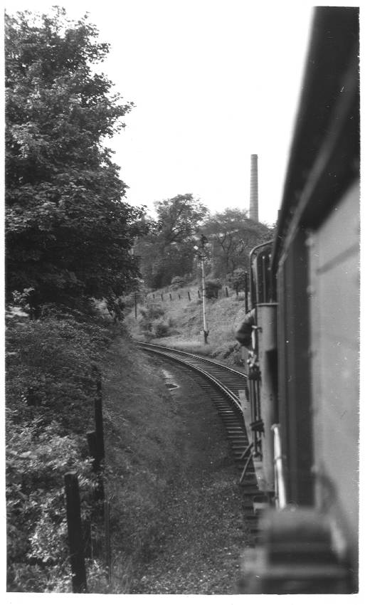
Hunnington Viaduct - 12/7/53
|
||
|
||
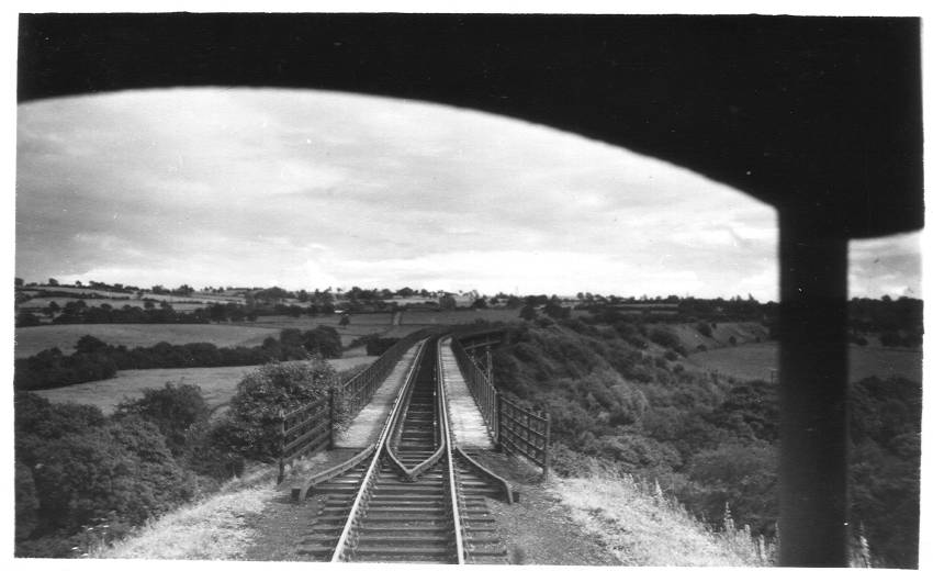
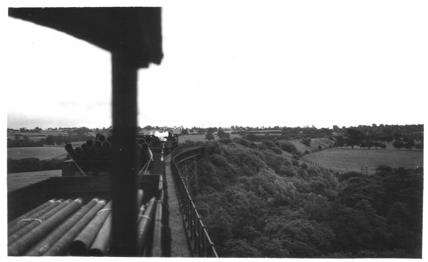
| This viaduct
was the most impressive part of the railway. The upper picture
was taken from the back of the train as it headed towards
Hunnington. In the lower picture we are steaming towards
Rubery.
This latter picture provides a slightly better view of the structure
itself. Here
is a detailed view of the viaduct. For a full, side profile,
don't miss the colour
slide of the viaduct! The viaduct carried the railway over an area known as Twiland Wood although MIAC describe it as Dowery Dell. David commented re the bottom picture:- "I suspect that the load is pipes manufactured at Coombeswood Tubes Works at Halesowen. These would have been loaded onto the train from the canal-rail interchange basin above Halesowen station (the site of Hawne Basin on the Dudley No. 2 Canal). " Dave got in touch to share these memories:- "As a child in the 40’s/50’s I used to walk on the planks underneath – the trick was to wait for a train to cross while you were in the middle and hang on for dear life as the whole structure shook. The vibration would cause the diagonal cross plates to open up about a foot and clang back and forth – the noise was deafening. Some of the planks were missing as well as the odd length of hand rail." |
Frankley Sdgs - 26/12/54
|
|
|
|
| Frankley sidings lay between the
viaduct and the overbridge on Newton Lane. David provided these
notes about the sidings:- "Frankley Sidings lay on the Rubery side of Dowery Dell Viaduct, 2 miles 7 chains from Halesowen. The sidings were not laid down for the construction of Frankley Waterworks in 1902, but had been there since the opening of the line. Situated by a public road – Oxwood Lane – there had originally only been one siding, but a second one was added to reduce the risk of wagons running away on the line towards Halesowen. So, if a train travelling towards Rubery had wagons to be left at Frankley, the remainder of the train had to be placed in the second siding while the shunting operations were carried out." |
Halesowen Branch Nr Site of M5 - 15/12/63
|
|
|
|
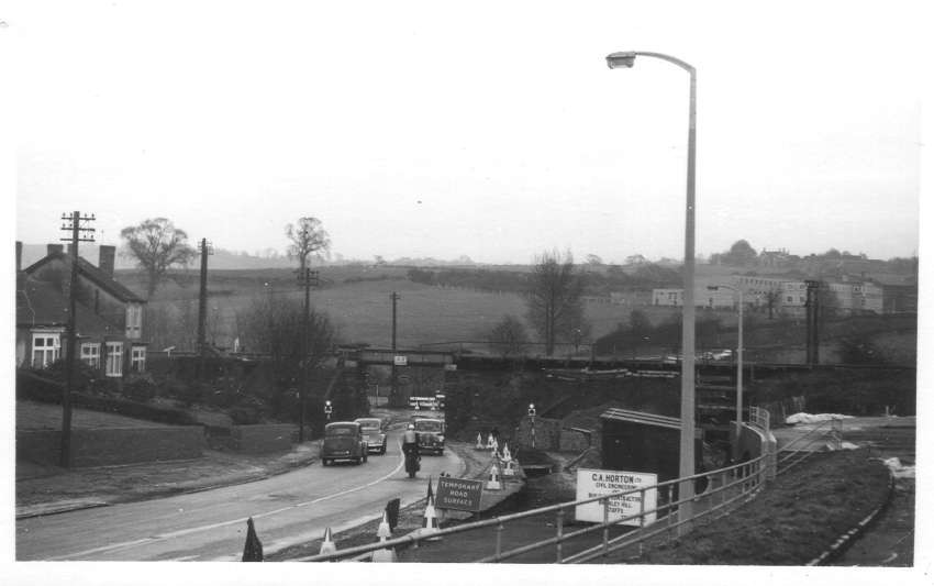
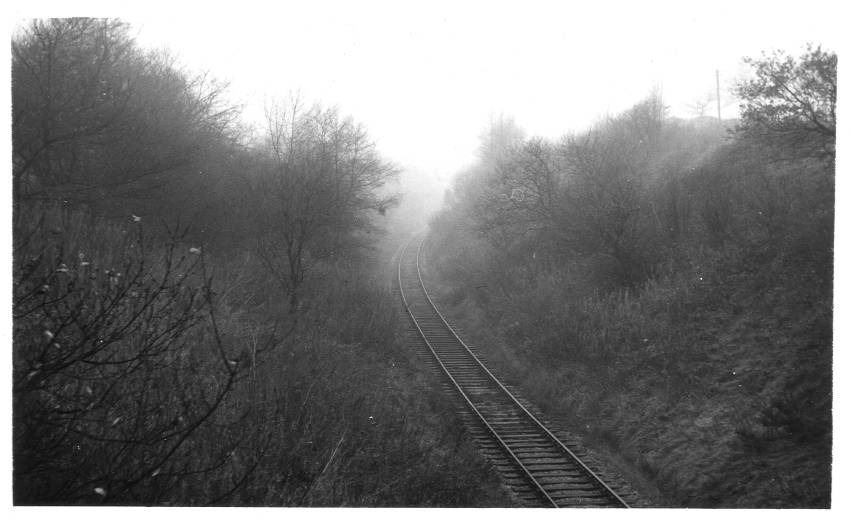
| This
picture, more than any other in the collection, indicates the
importance of the notes written on the back of each print.
Without the note this is just a scene of misty, single track
railway. The words, "Nr Site of M5", will send a chill down the
spine of Halesowen Railway fans for it was the construction of the
motorway to the west of Birmingham that saw the system closed down for
good. The picture was taken from the overbridge on Newton Lane, shown below, and is looking towards Halesowen. |
Halesowen Branch nr Frankley Sgds - 29/7/51
|
|
|
|
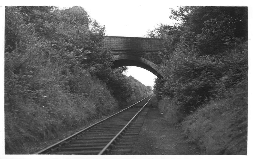
| This picture
shows the first of three overbridges between Halesowen and Rubery
stations. This bridge carried Newton Lane over the line, near its
junction with Yew Tree Lane and Oxwood Lane. The view is towards
Rubery. The bridge 'survives' to this day but it's difficult to visualise as the cutting was filled in the late 1980's. Here is a picture of the site from April 2006. |
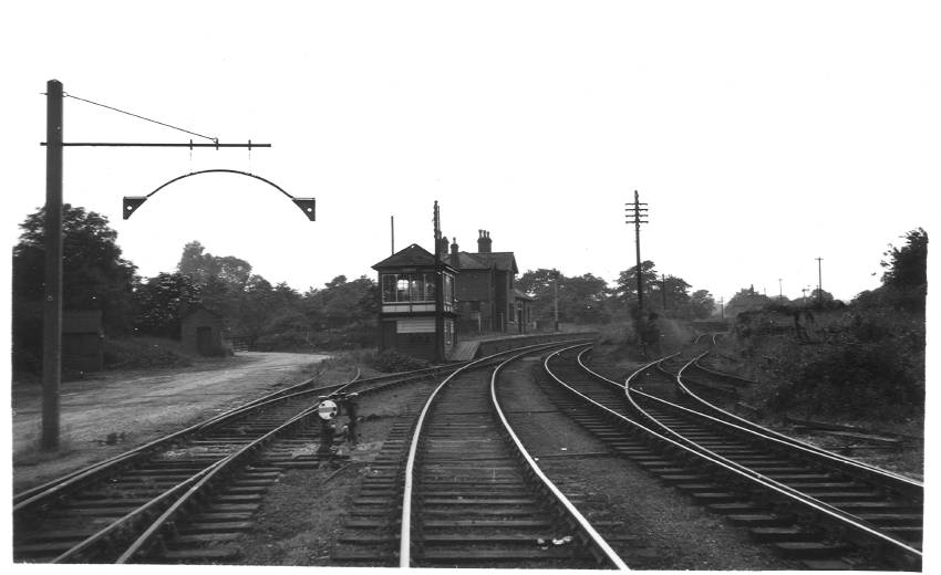
Holly Hill Crossing - 12/7/53
|
|
|
|
| This
crossing was where the line met Holly Hill on the approach
to Rubery Station. The station is visible just to the left of
centre. |
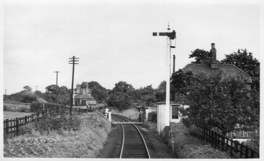
Rubery Stn - 31/5/54
|
|
|
|
| Having moved past Holly Hill
crossing, this shot shows the station from its western end. See
below for an opposing view. |
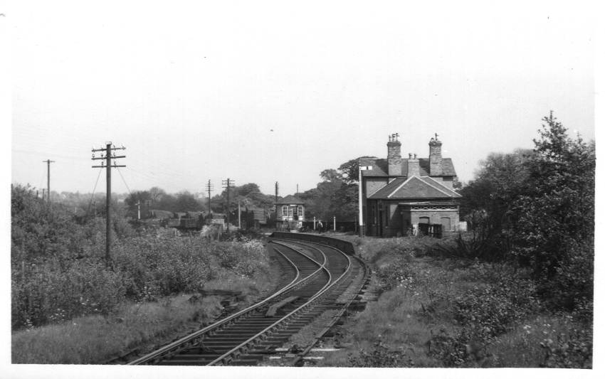
Rubery Station - 11/7/54
|
|
|
|
| The station
at Rubery was to the south of the line so this shows the view that
would be seen were we heading towards Hunnington. Rubery station provided the only 'passing loop' on the branch (i.e. where one train could pass another on a separate line) as the railway up to Halesowen was single-track. |
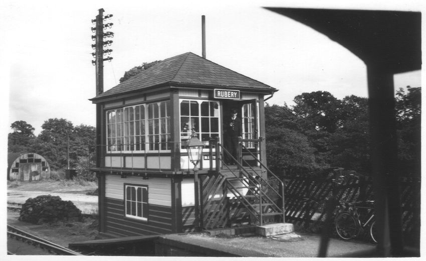
Rubery Box - 12/7/53
|
|
|
|
| This view is
taken from the back of the train as it heads toward Hunnington.
What a cracking pose the signalman is striking! |
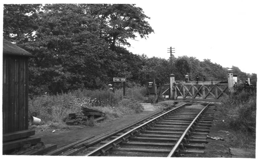
Frogmill Crossing nr Rubery - 11/7/54
|
|
|
|
| Frogmill
Crossing was located where the line crossed Rubery Lane. This
view is looking towards Longbridge. A close up view of the
controls can be seen here. This picture shows the site of the crossing as it is now. |
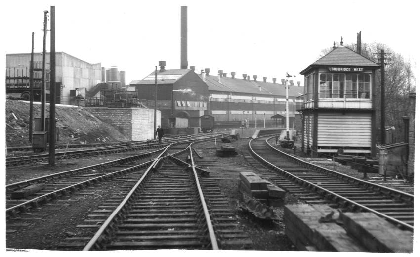
Longbridge West from West - 12/3/62
|
|
|
|
| Here we are
approaching Longbridge Station. The Rover works are the major
feature here. |
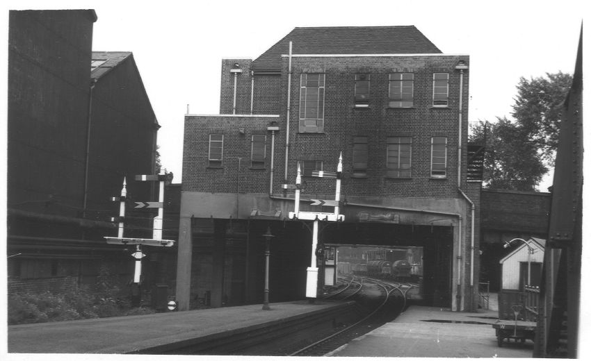
East End of Longbridge Station - 11/7/54
|
|
|
|
| This view
shows the back of the station building at Longbridge. The
building remained
in place for many years, although it was unused during that
time. It could be
found on the A38 near the junction of Bristol Road South and Lickey
Road. However, the building was finally demolished in June 2012
as the major
redevelopment of
Longbridge includes plans to demolish the
bridge and realign the A38. |
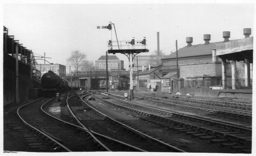
Longbridge East - 12/3/62
|
|
|
|
| In this
picture we are looking back to the station that is in the picture
above. Longbridge East Box can be seen near the road
bridge. Surprisingly, it survived until September 2011 when the
redevelopment of Longbridge saw the structure lost forever. Here
is a picture
from April 2006. My thanks to Paul from providing this modern view of the scene at the tail end of 2009. |
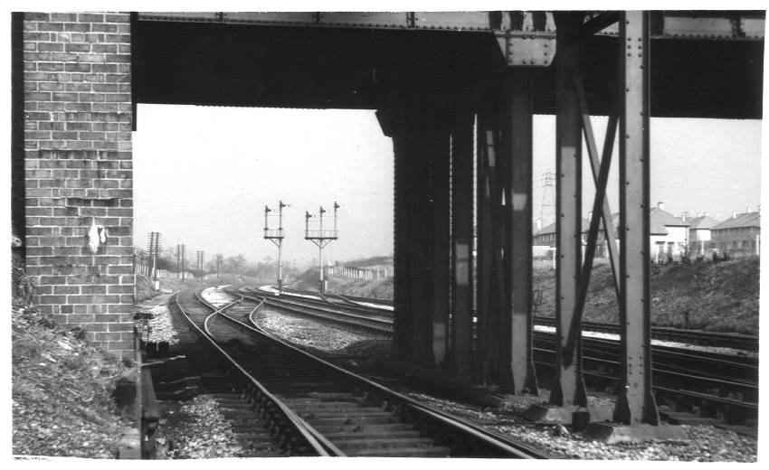
Halesowen Junction - 12/3/62
|
|
|
|
| This is
where the Halesowen Railway joined the lines of the Midland
Railway. The bridge in the foreground carries Longbridge
Lane. Underneath the bridge is where the site of the current
Longbridge Station, part of the Cross City Line, can be found. |
 |
 |
