Birmingham and Local Stations A-K in Colour
Covers Bournville, Brighton Road, Camp
Hill, Hazelwell, Kings
Heath and Kings NortonMove cursor over pictures for more information
Bournville
|
|||
|
|||
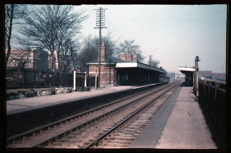
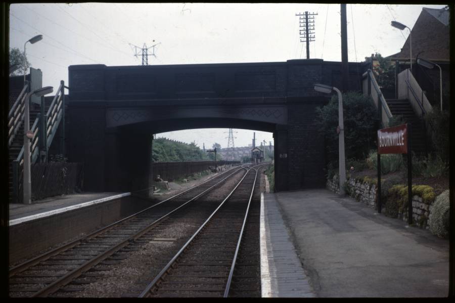
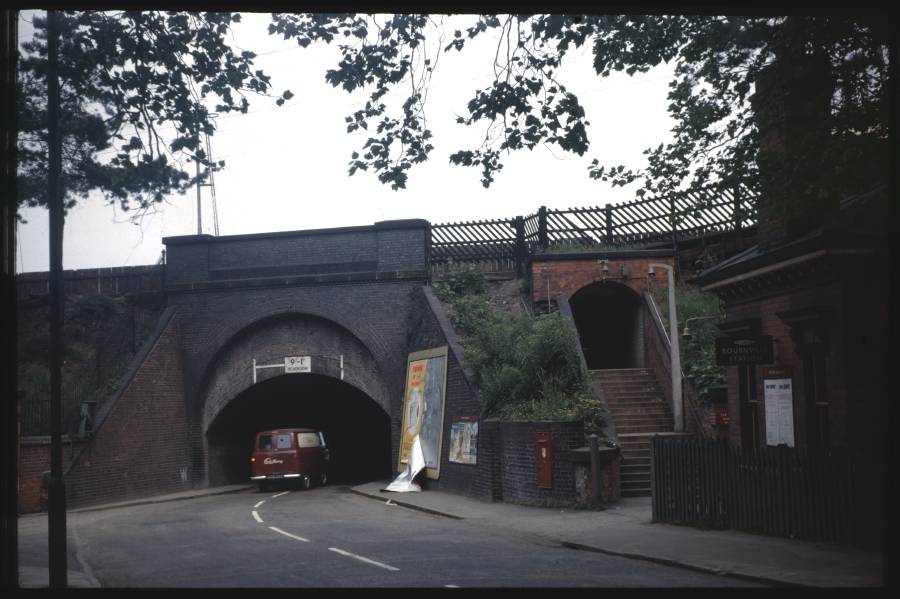
| Three fascinating pictures of
Bournville Station. The top picture from 1956 is a little out of
focus but shows Cadbury's to the left and provides a glimpse of the old
'Waterside' wharf to the right. The middle picture shows the road
bridge that carries Mary Vale Road. Finally, my favourite is the
bottom one that is of the station entrance in Bournville Lane.
Note the Cadbury's van heading under the bridge. |
Brighton Road (Site of)
|
|
|
|
| Alas, Brighton Road station on
the Camp Hill line had long since disappeared when my father visited
the site in 1957. The Rail
Around Birmingham site tells us that is closed in 1941 and had
wooden platforms so there is nothing left to see above. I originally said that the picture was taken on the site of the city bound platform looking towards Moseley but Peter got in touch with these comments:- "I’m afraid that I’m going to disagree with your caption to
this picture.
If you look at the pictures of King’s Heath and Moseley, the
telegraph pole route is on the city-bound side of the tracks. It
therefore seems reasonable to me that it would be in the same place at
Brighton Road, so I believe that the picture is looking towards Camp
Hill, not Moseley.
I also believe that the colour-light signal that we can see
the back of is the Brighton Road Intermediate Block Home signal that
was provided here when Brighton Road box was abolished. The signal was
operated from Camp Hill box and broke up the section between there and
King’s Heath, so that two freight trains could be climbing the bank
between Camp Hill and King’s Heath, separated by the IB signal. The
distant for the colour-light was a lower arm beneath Camp Hill’s Down
Starting signal, which was situated on a bracket on the embankment by
the bridge over Ombersley Road."
|
Camp Hill
|
||
|
||
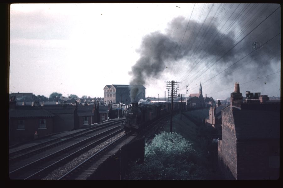
| For those of you hoping to see a
colour picture of the station, I apologise. But I don't think you
can complain! The picture of 43926 was taken from Camp Hill Box,
just north of the station itself. The tall building behind the
plume of smoke was and grain store and was part of Camp Hill
Goods. The tower to the
right of centre indicates the position of King Edward's Camp Hill
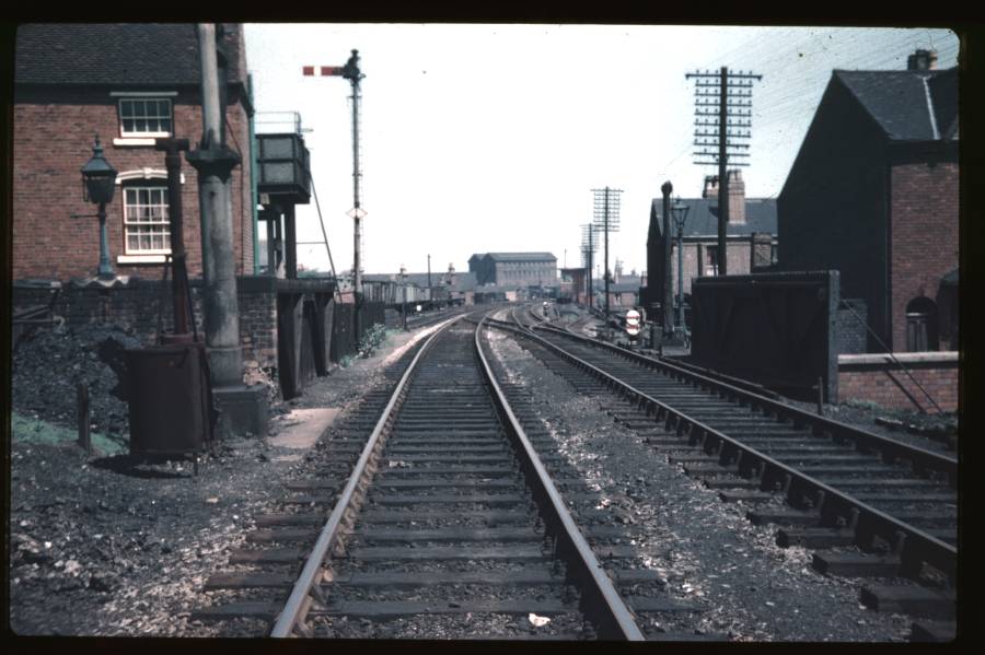
School. The second picture is closer to the station but still reveals nothing of the buildings themselves. The bridge in the foreground was over Montpellier Street. To the left we can see a water tower and, beyond that, Highate Coal Wharf. The signal box where the upper shot was taken from can just about be seen to the right of the grain store. |
Hazelwell
|
||
|
||
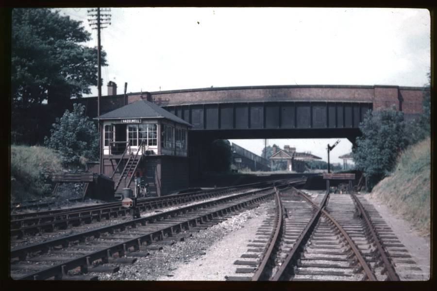
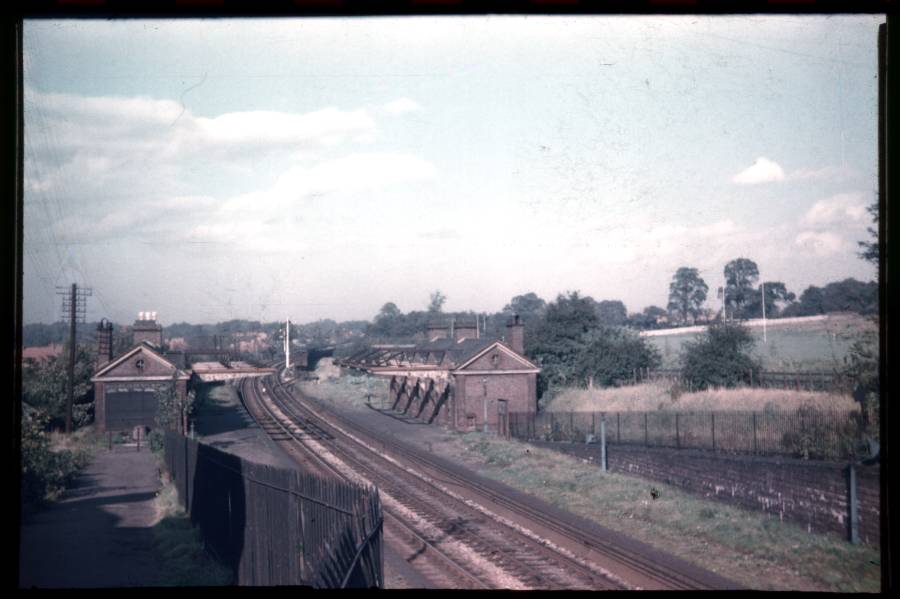
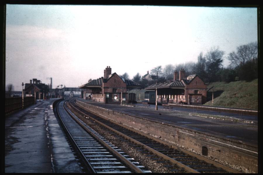
| Two excellent shots of Hazelwell
station. The upper picture was taken from just south of Cartland
Road and that is the road being carried by the bridge that dominates
this shot. A small section of sidings can be seen to the
right.
The lower shot shows the approach to the station from the entrance in
Cartland Road. Again, a small section of sidings can be seen just
beyond the station itself. |
Kings Heath
|
||
|
||
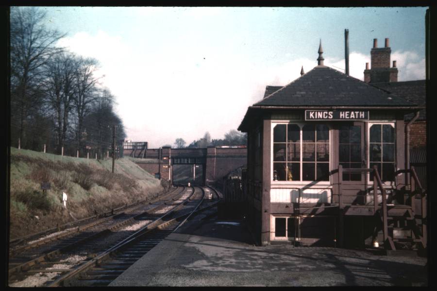
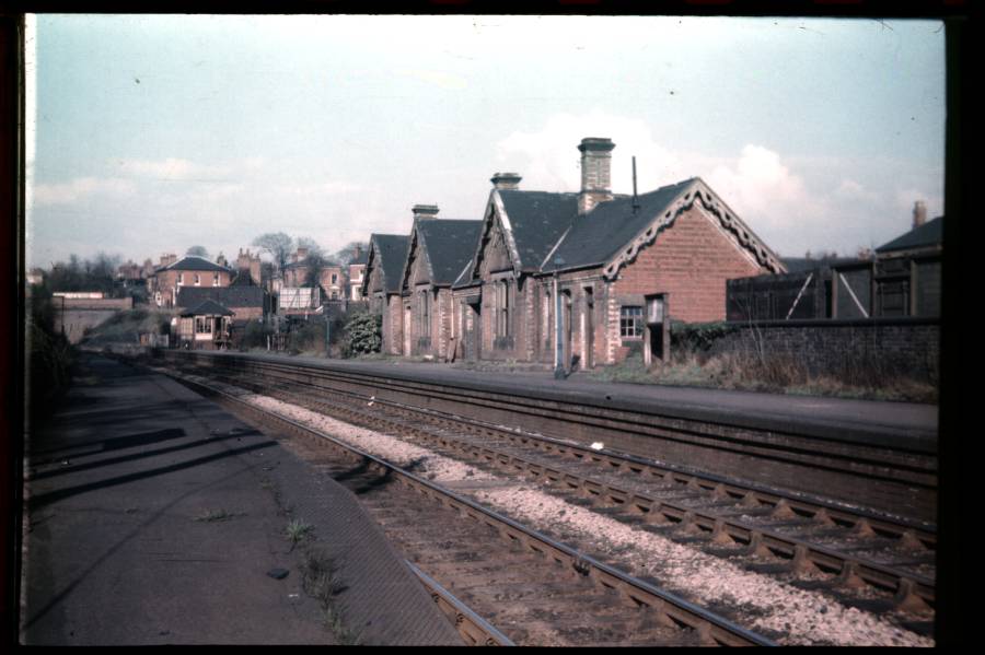
| Kings Heath box looks very spick
and span. The same can not be said of the decaying station
building... Both pictures are taking looking towards the city. The road bridge carries Kings Heath High Street. Just under this bridge was Kings Heath Ballast Sidings and my father took a cracking shot of this on 30 May 1955. |
Kings Norton
|
|||
|
|||
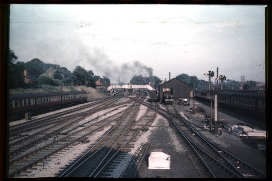
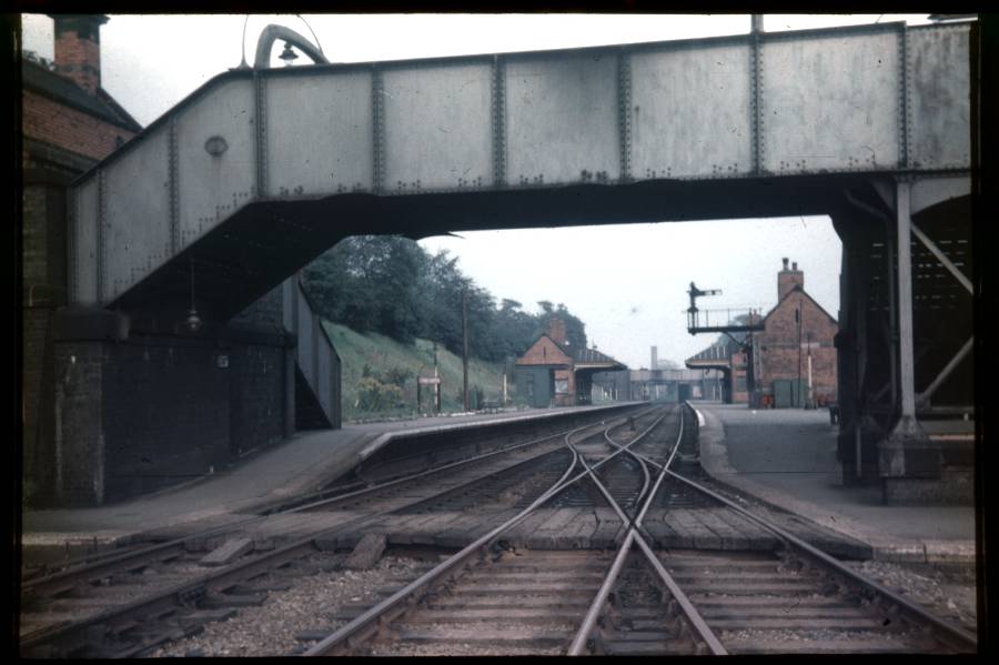
| Three shots that clearly show
the importance of Kings Norton station in the 1950's. The uppermost not only shows the four platform station but also shows a section of goods yard and shed. To the right, the carriage sidings can be seen. In the middle picture, my father has captured the northern half of the station from under the footbridge. The bottom picture is taken looking in the opposite direction to the other two - out of city and towards Northfield. The signal box from which the top picture was taken can just about be seen under the footbridge. |
 |
 |
